http://www.flickr.com/photos/esbenthomsen/7555560998/in/photostream
Everybody talks about the weather but nobody does anything about it.
Going kayaking, cycling or walking in and around Sonderborg I often check the weather – multiple times – to see if I can dodge a rain cloud or get out and home before the wind picks up. Here is a quick overview of the resources I have used. I would love to hear if you have any other resources you use.
Websites
The main resource in Danish is DMI (Danish Meteorological Institute). And if there is one thing Danes like to complain about more than the weather it’s the weather forecasters at DMI. One of this summer’s stories in the papers were that DMI was the worst of the Scandinavian agencies to predict the weather. Hwever DMI debunked that. In a summer like the one we’ve just had with a lot of scattered, very local rain DMI’s rain predictions can be quite misleading so keep that in mind.
Byvejr (What’s coming)
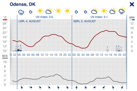
When I look for forecast I first look at Byvejr where they predict the local situation broken down by half hour columns:
Above the first graph is the general prediction. The first red line is the temperature. The blue columns at the bottom are rain or snow measured in mm. The second graph shows wind predictions with the red being gust wind speed and the blue being average wind speeds. At the bottom you can see wind direction.
DMI rain/snow radar (What has been)
After that I take a look at the radar images where a number of radars across Denmark produce a map of the country.
The image is an animation that shows the past hour of weather changes with an image every 10 min. The newest image is at least 20 minutes old so you have to speculate a bit in how the clouds move if you are trying to dodge rain using this. The blue dots indicate lightning with triangles showing cloud-to-ground lightning and diamonds showing where lightning went cloud-to-cloud. Keep in mind that the radar we are depending on here in Sønderborg sits on Rømø and it seems to have a bit of a blind spot when it comes to weather over the border region.
Weather stations
There are two local official weather stations on DMI’s list. That is Sønderborg Airport and Kegnæs Fyr.
Wetter Speigel
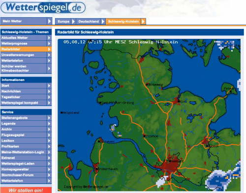
At a local camp site I was talking to a guy who always used the radar from the German provider Wetter Speigel as it gave better insight into rain coming than DMI according to him:
Nordwind EV
I recently came across an article in Blandt Naboer/Unter Nachbahn about a grassroot run network of weather stations called Nordwind in Schleswig and they even have one in Sonderborg.
Some where in Sonderborg they have a weather station that gives live data which is great for sailors and surfers.
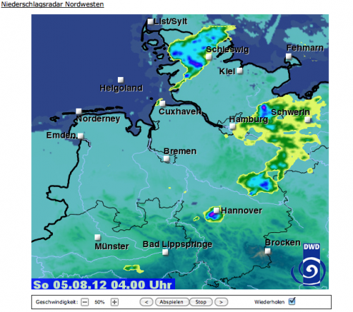
DWD (Deutscher Wetterdienst) The German equivalent of DMI also creates radar images and Nordwind EV puts these together in an animation of the past 2 hours Click Abspeilen to get the animation started.
Smartphone App
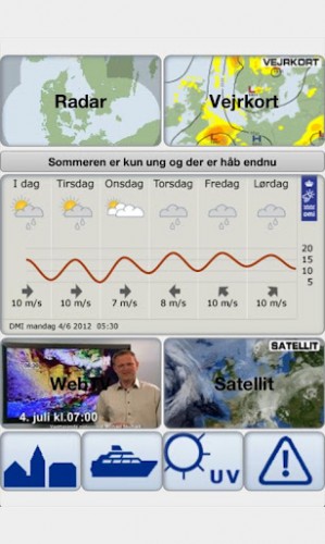
My phone is often the first point of attack when I want to know what is coming. DMI and Woerk has made one iphone app called Byvejret that shows – as the title indicates – the same as Byvejr online in a slick wrapping.
In the last update they improved the visuals but also removed radar.
The android app, called DMI Weather, recently got an upgrade but still shows radar and webTV unlike the IOS version.
DMI also has a mobile site that you can bookmark for easy access to countrywide forecast in English or the radar image.
So there you have it. The resources I use to work out the weather. What’s your tool of choice?
UPDATE 23-9-2012: @Casper_O told me about the Norwegian weather service he uses called YR.no. They are very reliable he said and their page on Sønderborg has a lot of info with cloud prediction and web cams:
The quote in the beginning of this post has been attributed to Mark Twain but there is a different story behind it.
The amazing photo at the top of the cloud and the castle is by Esben Tomsen


